thecartographicarts@gmail.com
+44 (0)1453 768 598

Original vintage style decorative maps | incredible detailed | stunning designs | up-to-date cartography - 2019 - 2026 | limited edition | giclée printing


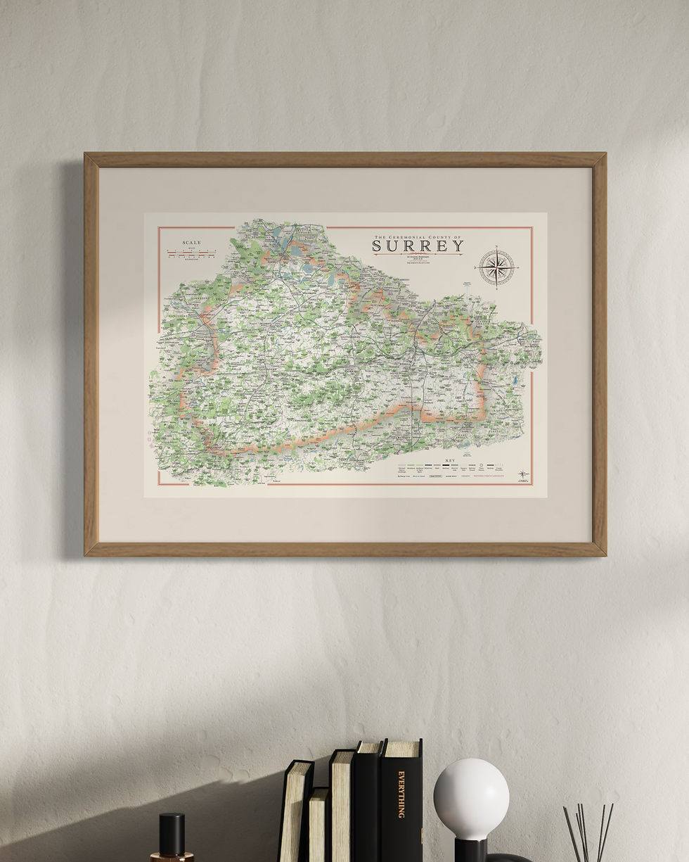
Surrey County Maps
Year of Design - 2022
There are two versions of my Surrey county map, one with all the districts presented and the other of the county as a whole.
One of the Home Counties, neighbour of London, surprisingly, Surrey has the highest percentage cover of woodland of any county in England and I've noticed also has a lot of golf courses!
Surrey maps available in two sizes
Large: B1 - 100 x 70 cm (original design size)
Small: A1 - 84.1 x 59.4 cm
The Surrey county maps are available on 270 gsm archival fine art paper or 280 gsm cotton / polyester canvas, framed or unframed.
(gsm - grams per square meter)
Surrey's neighbours Kent and East Sussex are also available.
Details on the Map
Civil parish borders and labels, all place names, woods, parks, golf courses, rivers, lakes, park, hilltops, reservoirs and military areas.
There is a complete road and rail network with station and line labels.
Hill shading brings the relief and topography of Surrey alive on the map.
All long distance walking routes are plotted and labelled including the Greensand Way, Pilgrims Way and Downs Link.
Sites of significant historical & cultural interest are also be plotted on the maps complete with reference sections.
For more details on the specifications and build quality framed and unframed maps visit the specifications page.

Surrey Hills Maps
Year of Design - 2022
The Surrey Hills stretch across the entire county, accounting for 26% of surreys' land area. This wonderful landscape is protected as a National Landscape. It is half of the north downs and sister to the Kent Downs to the east which similarly stretches across Kent.
There are two versions of the map available. a single colour for the whole National Landscape and one which shows the different portions of the surrey districts which make up the National Landscape.
Available in three sizes
Large: B1 - 100 x 70 cm (original design size)
Small: A1 - 84.1 x 59.4 cm
Reduced: B2 - 70 x 50 cm
The Surrey county maps are available on 270 gsm archival fine art paper or 280 gsm cotton / polyester canvas, framed or unframed.
(gsm - grams per square meter)
For more details on the specifications and build quality framed and unframed maps visit the specifications page.
Details on the Map
The Surrey Hills maps are artwork is taken directly from the Surrey county map so all the details packed in there are the same here.
The main difference is the supplementary map of the whole country with the Surrey Hills highlighted to show clearly their extent within the county.

Surrey Mini Maps
My Surrey and Surrey Hills maps have been re-designed for the mini map series. These have less detail to make them work at smaller sizes with large amounts of labelling removed, prioritising place names. The civil parish borders and labels are lost along with the walking routes.
Available sizes
Large: A2 - 59.4 x 42 cm
Medium: B3 - 50 x 35.3 cm
Small: A3 - 42 x 29.7 cm
Visit the Mini Map Series page for more details on the mini map series