thecartographicarts@gmail.com
+44 (0)1453 768 598

Original vintage style decorative maps | incredible detailed | stunning designs | up-to-date cartography - 2019 - 2026 | limited edition | giclée printing

Kent County Maps
Year of Design - 2021
My Kent county maps are available in three versions. The county as a whole and two versions with the districts of Kent presented. The first has a brighter colour palette and the second is part of my 'Autumnal Series' which uses a softer colour balance inspired by the colours of Autumn.
The maps looks brilliant. The landscape and countryside of Kent his fabulous with wonderful ridges and contours that stretch across the county. Kent is also packed full of 'great' British history from the Battle of Hastings and Canterbury Cathedral to the Robertsbridge Codex and the Channel Tunnel.
Kent Maps are available in two sizes
Large: B1 - 100 x 70 cm (original design size)
Small: A1 - 84.1 x 59.4 cm
East Sussex and Surrey, Kent's county neighbours are also available.
Details on the Maps
Due to the large size of Kent the map is a little dense than detail than most of my maps making for a striking piece. All the usual details are included from civil parish borders and labels, all place names, woods, parks, golf courses, rivers, lakes, parks, hilltops, reservoirs and military areas.
There is a complete road and rail network with station and line labels.
Hill shading brings the relief and topography of Kent alive on the map.
All long distance walking routes are plotted and labelled including the Wealdway, Pilgrims Way, Greensadn Way and Stour Valley Walk.
Sites of significant historical & cultural interest are also be plotted on the maps complete with reference sections.
The Kent county maps are available on 270 gsm archival fine art paper or 280 gsm cotton / polyester canvas, framed or unframed.
(gsm - grams per square meter)
For more details on the specifications and build quality framed and unframed maps visit the specifications page.


Kent Downs Maps
I have produced two versions of the Kent Downs map. The National Landscape as a whole and a second map with the different portions of the districts of Kent that make up the Downs.
Kent Downs maps are available in two sizes.
Large: B1 - 100 x 70 cm (original design size)
Small: A1 - 84.1 x 59.4 cm
The Kent county maps are available on 270 gsm archival fine art paper or 280 gsm cotton / polyester canvas, framed or unframed.
(gsm - grams per square meter)
Details on the Maps
The artwork for the Kent Downs maps is largely the same as the Kent county maps with all the same details over the Kent Downs area including all the relevant long distance walking routes.
The one major difference is a supplementary map of Kent and the extent of the downs across the county.
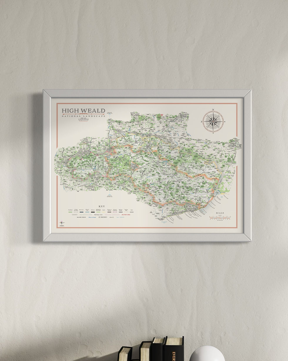
I have also produced red maps of the Surrey Hills and High Weald.

Kent Mini Maps
My Kent maps have also been re-designed for the mini map series with less detail and no 'sites of significant historical and cultural interest' in smaller print sizes
Large: A2 - 59.4 x 42 cm
Medium: B3 - 50 x 35.3 cm
Small: A3 - 42 x 29.7 cm
Visit the Mini Map Series page for more details on the mini map series
Shop


Frame Options

thin matte black

thick matte black

thin light walnut
