thecartographicarts@gmail.com
+44 (0)1453 768 598

Original vintage style decorative maps | incredible detailed | stunning designs | up-to-date cartography - 2019 - 2026 | limited edition | giclée printing

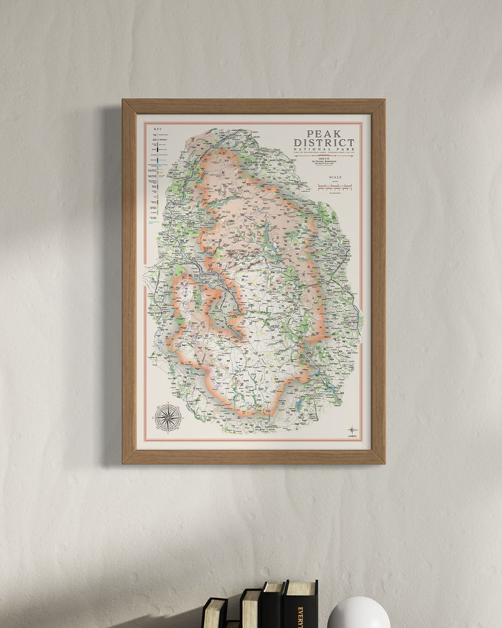
The Peak District
Peak District Wall Maps
Year of design 2022
The Peak District maps are some of my favourites. They sit on the canvas with an elegance not captured by many maps. The county sections version I particularly like where this innovation in design works so well.
There are two main versions of the Peak District map like most of my National park and landscape maps with one reflecting the different counties that contribute to the national park (Greater Manchester, Cheshire, South Yorkshire, West Yorkshire, Staffordshire and Derbyshire) and the other as a single geographic area.
There are three sizes available for each
Large: 100 x 70 cm - B1 (original design size)
Small: 84.1 x 59.4 cm - A1
Reduced: 70 x 50 cm - B2
The Peak District maps are available on 270 gsm archival fine art paper or 280 gsm cotton / polyester canvas.
Details on the map
The delicately applied hill shading brings the landscape of the Peak District alive, coupled with extensive labelling of the hilltops, lakes, reservoirs, moors and valleys.
Long distance walking routes are plotted and labelled on the map including the Pennine Way, Trans Pennine Way, Limestone Way and Peak District Inn Way.
Sites of significant historical & cultural interest are also plotted on the maps complete with reference sections. Examples include The Roaches and the village of Flash, the highest in the country.
Take a look at the Cheshire maps here
Take a look at the Staffordshire maps here
Take a look at the Derbyshire maps here

Peak District Mini Maps
My Peak District maps have also been re-designed for the mini map series. These have a lot less detail to make them work at smaller sizes. This includes removal of the walking routes and significant amounts of labelling particularly woods, moors, and hilltops.
The'sites of significant historical and cultural interest'have also been removed.
Large: A2 - 59.4 x 42 cm
Medium: B3 - 50 x 35.3 cm
Small: A3 - 42 x 29.7 cm
Visit the Mini Map Series page for more details on the mini map series

Reviews
Shop


Frame Options

thin matte black

thick matte black

thin light walnut
