thecartographicarts@gmail.com
+44 (0)1453 768 598

Original vintage style decorative maps | incredible detailed | stunning designs | up-to-date cartography - 2019 - 2026 | limited edition | giclée printing


Dartmoor Maps
Year of Design - 2026
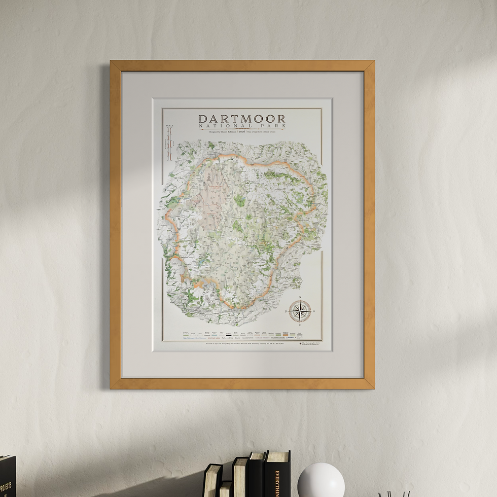
The large Dartmoor maps are packed with incredible detail. All place names are labelled, along with all tors, commons, hilltops and downs. I have also added as many farms as possible, although I cannot guarantee this is exhaustive.
Long distance walking routes are plotted on the map including the Dartmoor Way, Abbots Way, West Devon Way and Dartmoor Ramble
Civil parish borders and labels, woods, parks and golf courses, hill shading and, rivers, leats, complete road and rail network with station labels and military areas, airstrips and mires.
There is also a researched Sites of Significant Historical and Cultural Interest reference section including everything from Bronze Age sites to clapper bridges and stone crosses.
Available in two sizes
Large: B1 - 100 x 70 cm
Small: A1 - 84.1 x 59.4 cm
framed map options available for 270 gsm archival fine art paper and 280 gsm cotton / polyester canvas prints
Check out other national parks and national landscapes here

A certain amount of detail its removed to make the map work at smaller sizes. The farm names are removed along with the walking routes, and civil parish labels and borders.
The Sites of Significant Historical and Cultural Interest are also lost.
Available in 3 print sizes
A3 - 42 x 29.7 cm, B3 - 50 x 35.3 cm, A2 - 59.4 x 42 cm
4 framing options
A3 print with A3 frame, A3 print with mount in 40x50 cm frame, B3 print with mount in A2 frame, A2 print with A2 frame
3 frame types in each size
matt black, matt white and wood
You can also by a print properly mounted without a frame