thecartographicarts@gmail.com
+44 (0)1453 768 598

Original vintage style decorative maps | incredible detailed | stunning designs | up-to-date cartography - 2019 - 2026 | limited edition | giclée printing

Isle of Man Wall Maps
Year of Design - 2026
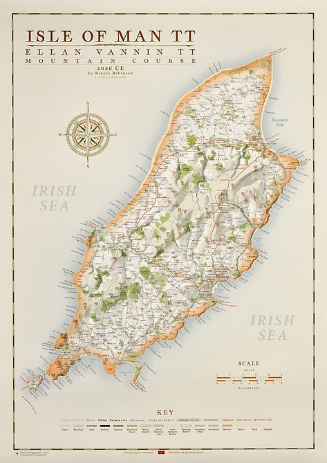
There are two versions of the Isle of Man wall map available. One has the Isle of Mann TT mountain route plotted on along with all corner and waypoint names.
Available in 24 sizes
Largest: A1 - 84.1 x 59.4 cm
Large: B1 - 70 x 50 cm (original design size)
Medium: A2 - 59.4 c 42 cm
Small: B3 - 50 x 35.3
Isle of Man maps available on 270 gsm archival fine art paper or 280 gsm cotton / polyester canvas (larger sizes only), both framed or unframed.
For more detailed information on specifications, paper, printing and build quality visit the specification page.
Details on the Maps
Rivers, streams, reservoirs, lakes, a complete road and rail network, woodland, moorland, parks, hilltops, golf courses, airports and runways and coastal features from the Calf of Man to Ayre Point.
All local authority and Sheading borders are plotted and labelled along with major historic and cultural sites such as Fairy Bridge, Castle Rushen and Meayll Circle.
Hill shading is applied across the map bringing the varied topography and relief of the Isle of Man to to life.