15% off for 2 & 20% off for 3 or more
discounts applied to your basket


Hertfordshire Maps
Year of Design - 2025
Two wall maps of Hertfordshire are available. One of the county as a whole and the other showing the districts and administrative areas of Stevenage, North & East Hertfordshire, Dacorum, Welwyn Hatfield, Broxbourne, Hertsmere, Watford and Three Rivers. These are all represented in different colours creating a very different look to the map.
Available in 2 sizes
Large: B1 - 100 x 70 cm (original design size)
Small: A1 - 84.1 x 59.4 cm
Hertfordshire maps available on 270 gsm archival fine art paper or 280 gsm cotton / polyester canvas, both framed or unframed.
For more detailed information on specifications, paper, printing and build quality visit the specification page.
Details on the Maps
Rivers, streams, reservoirs, lakes, a complete road and rail network, woodland, parks, hilltops, golf courses, airports and runways and military areas are all marked and labelled on the maps.
All civil parish borders and labels are also on the maps.
Hill shading is applied across the map bringing the gentle topography and relief of Hertfordshire to the map.
Long distance walking routes are plotted and labelled on the map including the Hertfordshire Way, Chiltern Way and Harcamlow Way.
Sites of significant historical & cultural interest are also plotted on the maps complete with reference sections. Examples include Berhamstead Castle, Gobions, St Albans Cathedral and Hatfield House.
Hertfordshire Mini Maps
My Hertfordshire maps have also been re-designed for the mini map series. With less detail and no 'sites of significant historical and cultural interest' but no loss of beauty in smaller print sizes.
The civil parish borders and labels are removed along with a lot of wood and park labels, prioritising place names. The long distance walking routes are also removed.
Three Available Sizes
Large: A2 - 59.4 x 42 cm
Medium: B3 - 50 x 35.3 cm
Small: A3 - 42 x 29.7 cm
Visit the mini map series page to read more about them and see what maps are available.
Visit the Chiltern Hills map page.


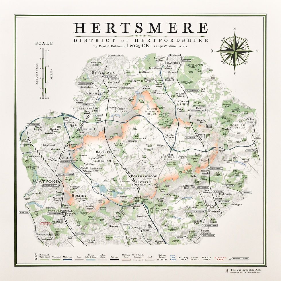
Hertfordshire District Maps
A selection of Hertfordshire district maps have also been produced including Dacorum, North & East Hertfordshire, Hertsmere, City of St Albans and Welwyn Hatfield.
The sizes available for these vary for each map.